

 Two stories.
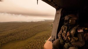
Let’s build this weather system up with our prayers and meditation.
Showers and storms for NSW’s ranges early next week
Graeme Brittain, Sunday January 5, 2020 – 14:16 AEDT
http://www.farmonlineweather.com.au/news/showers-and-storms-for-nsws-ranges-early-next-week/530831
A low pressure trough will draw moist air from the Tasman Sea over eastern parts of New South Wales over the next few days.
Showers and storms will mainly affect the Central Tablelands, Upper Hunter, Northern Tablelands and parts of the South Coast, with the highest totals probably occurring on Tuesday. Localised accumulations of 20-40mm are possible in any heavy shower or storm.
Lightning from storms may also spark new fires, and localised wind changes due to shower and storm activity could make the spread of existing fire more unpredictable.
Whilst rain will fall over some of the firegrounds in eastern parts of the state, unfortunately many places will see little, if any, rain from this system.
The region looks to dry out by Friday, as hot northwesterly winds develop ahead of another trough, which presents another problematic day on the firegrounds.
– Weatherzone
© Weatherzone 2020
Tweet
Credit: Thesundaily.my
Let’s calm this one down to a gentle rainfall with our prayers and meditations.
Tropical Cyclone Blake forms off north coast of WA
Ben Domensino, Monday January 6, 2020 – 12:20 AEDT
http://www.farmonlineweather.com.au/news/tropical-cyclone-blake-forms-off-north-coast-of-wa/530836
Tropical Cyclone Blake has developed off Australia’s northwest coast, becoming the country’s first named tropical cyclone of the 2019/20 season.
Blake formed around 240 kilometres to the north of Broome at 8am WST on Monday. At that time, the system was moving towards the east at nine kilometres per hour.
The cyclone should start to move south and approach Western Australia’s north coast later on Monday, possibly making landfall over the East Pilbara coast on Tuesday or early on Wednesday. At this stage, Blake could reach category two strength before crossing the coast.
While there is still some uncertainty with the future movement and development of this system, heavy rain and damaging to destructive winds are likely to develop along parts of the state’s West Kimberley and East Pilbara coasts between Monday and Wednesday.
A tropical cyclone warning was in place at 9am WST for the coast and adjacent inland between Kuri Bay and De Gre, including Broome.
After making landfall, the remnants of Tropical Cyclone Blake could travel southwards across WA later in the week, dragging moisture-laden air towards southern Australia. Models suggest that this injection of tropical moisture could cause some much-needed rain and thunderstorm activity over parts of southern WA, SA, Victoria, Tasmania and NSW between Thursday and Sunday. Unfortunately, it doesn’t look like this rain will be heavy enough to put out the fires in southeastern Australia.
Visit http://www.bom.gov.au/cyclone for the latest tropical cyclone warnings.
– Weatherzone
© Weatherzone 2020